We perform:
- Exploration activities even on hard terrains and in harsh climatic conditions.
- Resource and reserve estimation in accordance with international standards and the best industrial practices.
- Flexible price policy.
Mining and Metallurgy Institute is a large research and design company in the region. Meantime, it owns modern equipment park in the region and employs experienced, highly qualified staff with over 15 years of experience in geological exploration for different mineral commodities. We are cooperating with international companies, such as Strathcona Mineral Services, Oliver Geoscience International Ltd., Arminier – Open Pit Engineering Consulting and with many well-known independent specialists/experts.
Mining and Metallurgy Institute provides the following services both in complex or separately:
- Exploration drilling.
- Geological activities related to drilling.
- Geochemical survey.
- Exploration and engineering geophysics.
- Mineral resource/reserve estimation.
- Laboratory work.
- Topographic survey.
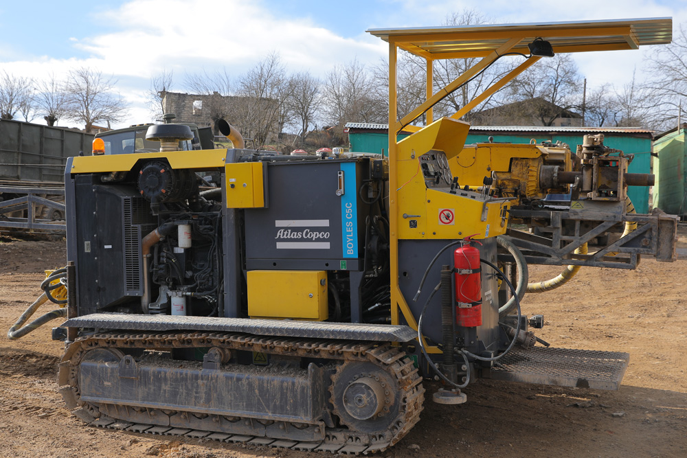
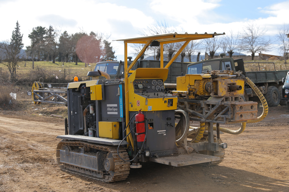
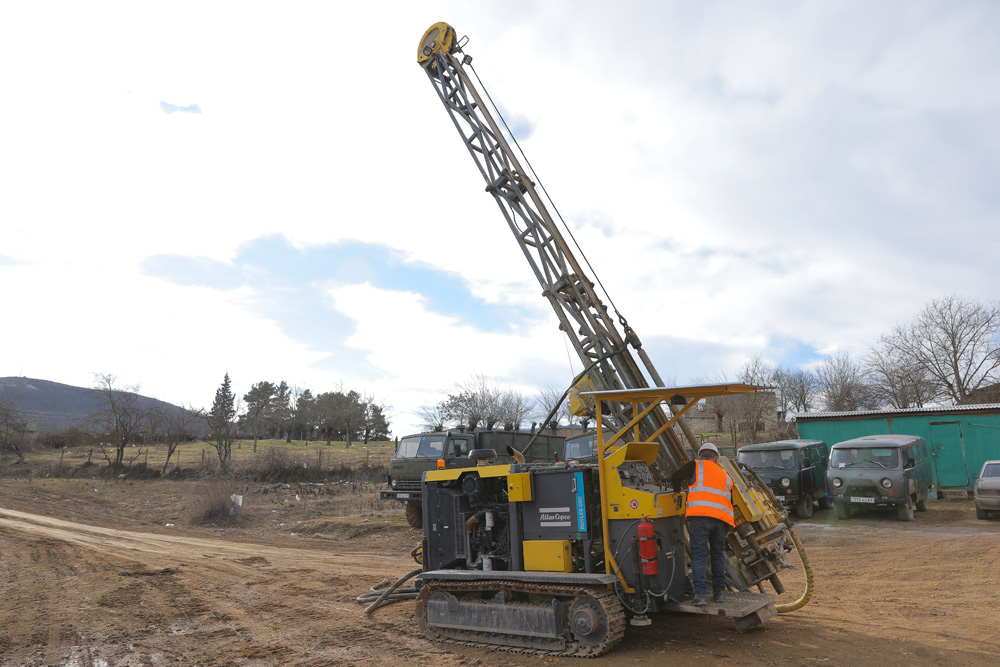
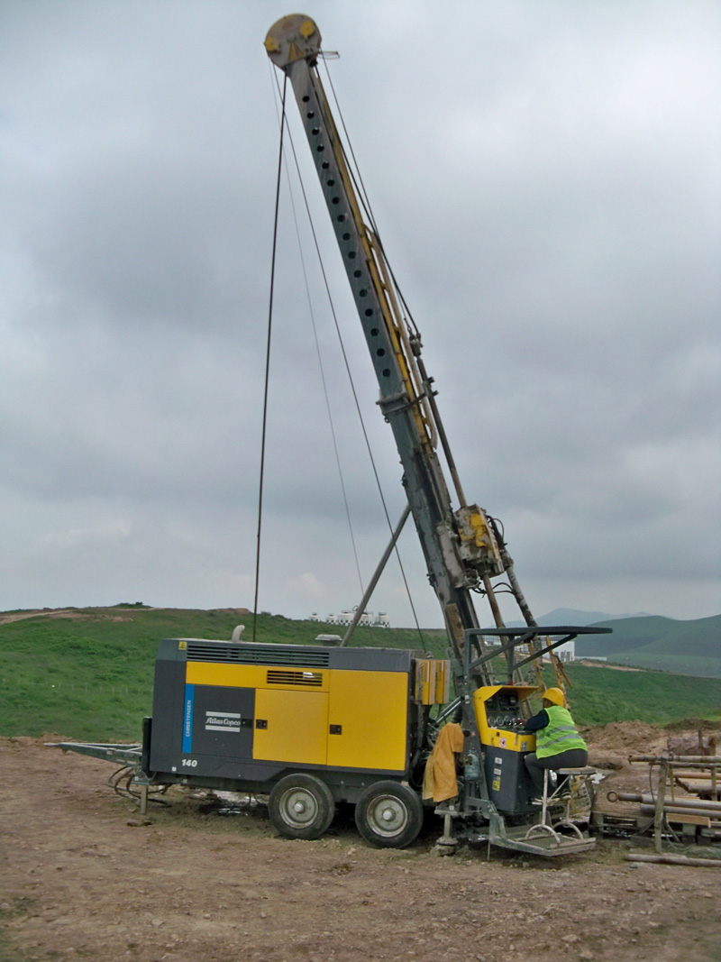
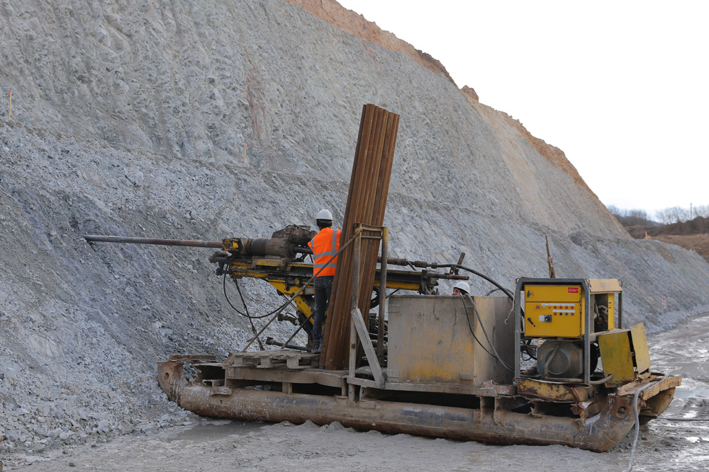
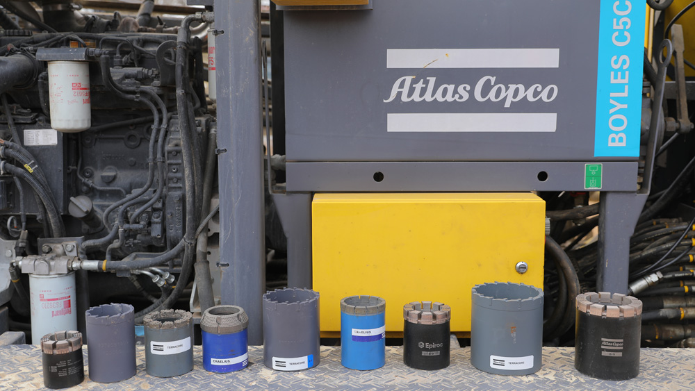
We operate the following drill rigs, all of them being produced by Atlas Copco: drill rigs Christensen CS-1000 P4, Christensen CS-1000 P6, two Diamec U6 rigs, as well as Christensen CS-140 and Boyles C-5C – produced in 2017-2018.
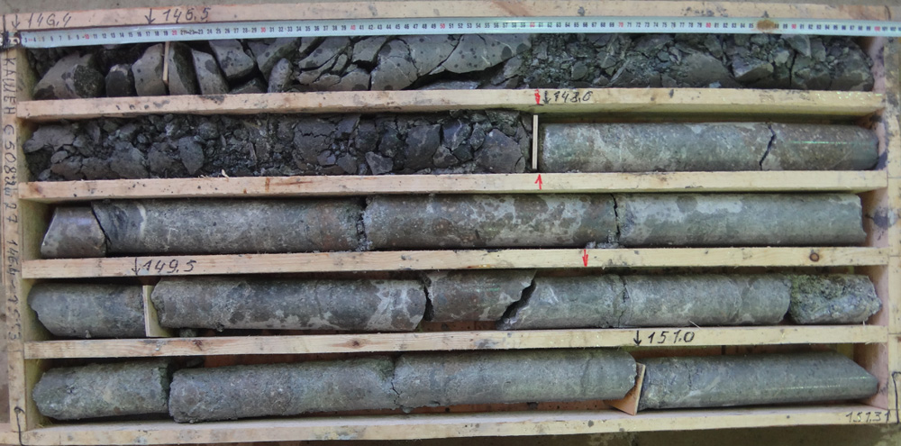
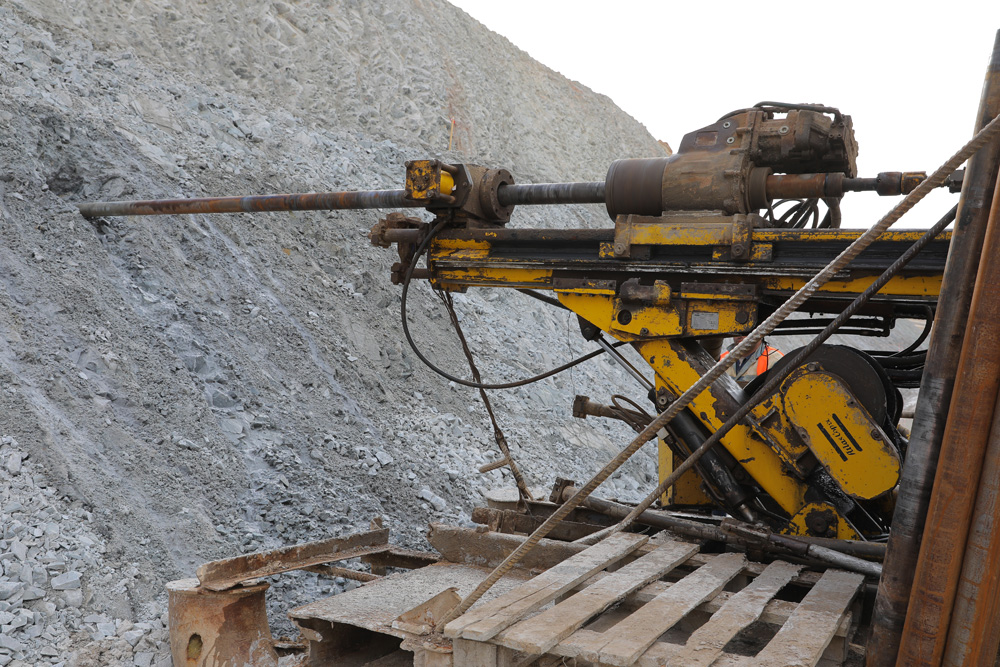
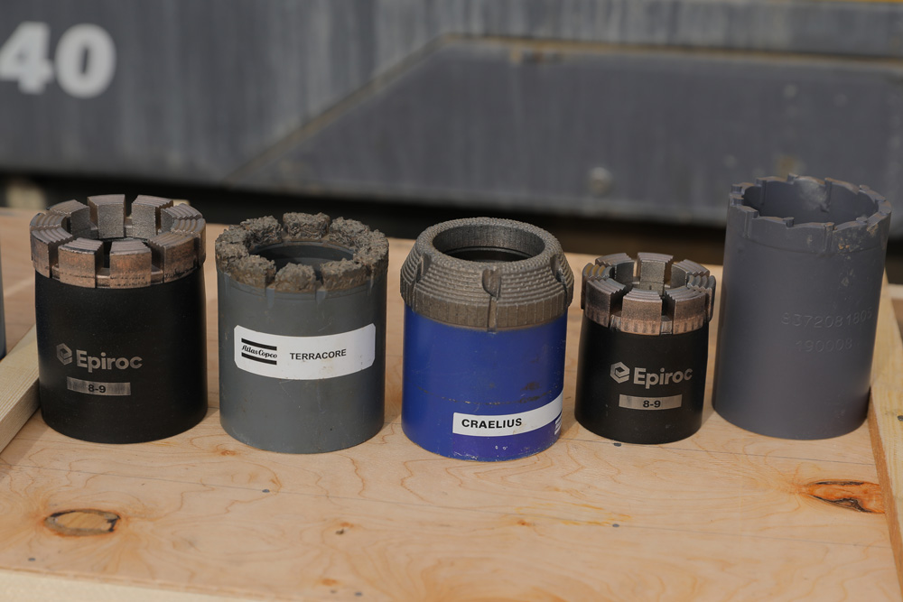
Utilizing modern triple-tube and double-tube drilling techniques and different diamond bits, we are capable to drill both surface and underground exploration holes and delivering 90% and higher core recovery in the most difficult boring conditions.
Our drilling services have been highly appreciated by international experts.
Main Technical Information of drill rigs
| Drilling Diameter | Approximate Drilling Depth Capability* (m) | Drill Core Diameter (mm) | ||||
| P6 | P4 | U6 | CS-140 | C-5C | ||
| NK/NQ (Ø 76 mm) | 500 | 500 | 350 | 1200 | 800 | 45.1-47.6 |
| HK/HQ (Ø 96 mm) | 400 | 350 | 250 | 800 | 500 | 61.1-63.5 |
| PK/PQ (Ø 122 mm) | – | – | – | 475 | 300 | 83.0-85.0 |
| Drilling Angle (º) | 45-90 | 45-90 | 0-360 | 45-90 | 45-90 | |
* These indices are based on vertical drilling in monolithic rock
Self-propelled Christensen CS-1000 P4, Christensen CS-1000 P6, and Boyles C-5C surface drill rigs give the possibility to drill holes for any purposes with PQ, HQ and NQ diameters (the former size only with CS-140 and C-5C rigs) from minimum size drilling platforms.

")
")

Depending from the size of the feeder (850 mm and 1800 mm), Diamec U-6 drill rigs give the possibility to drill holes from minimal size drilling chambers at any angle (0-360º).


Easily dissolved polymer solutions are harmless for the environment and are used as washing liquid, and super-boring diamond bits are used as rock-wrecking tools providing high productivity.


The company offers also staff trainings as well as provides consulting services in the drilling sphere.
To date, we have drilled about 300 000 meters of exploration drill holes in different deposits.
- Drill core geological logging.
- Drill core sampling
- Core sampling for bulk density determination implying an in-house developed methodology.
- Drill core geotechnical logging and sampling.
- Sample preparation.
- Preparation and implementation of a geochemical sampling program.
- Mono-element and poly-element analysis, identifying anomalies and assessment of their prospectivity.

Map of distribution of PCA-1 (CuMoSAuAgW(BiK)) component. Map of copper distribution from soil geochemistry data. - Target generation and preparation of different related maps and reports.
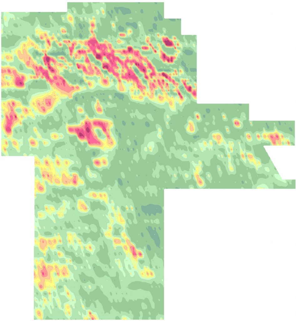
- Conventional stream sediment (SSED) and BLEG sampling.
- Data and catchment basin analysis.
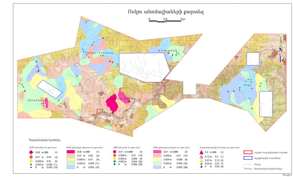
BLEG and SSED gold distribution map. - Prospectivity assessment of SSED/BLEG anomalies and preparation of prognostic maps.


Geophysical studies can be carried out by the following methods and in different scales:
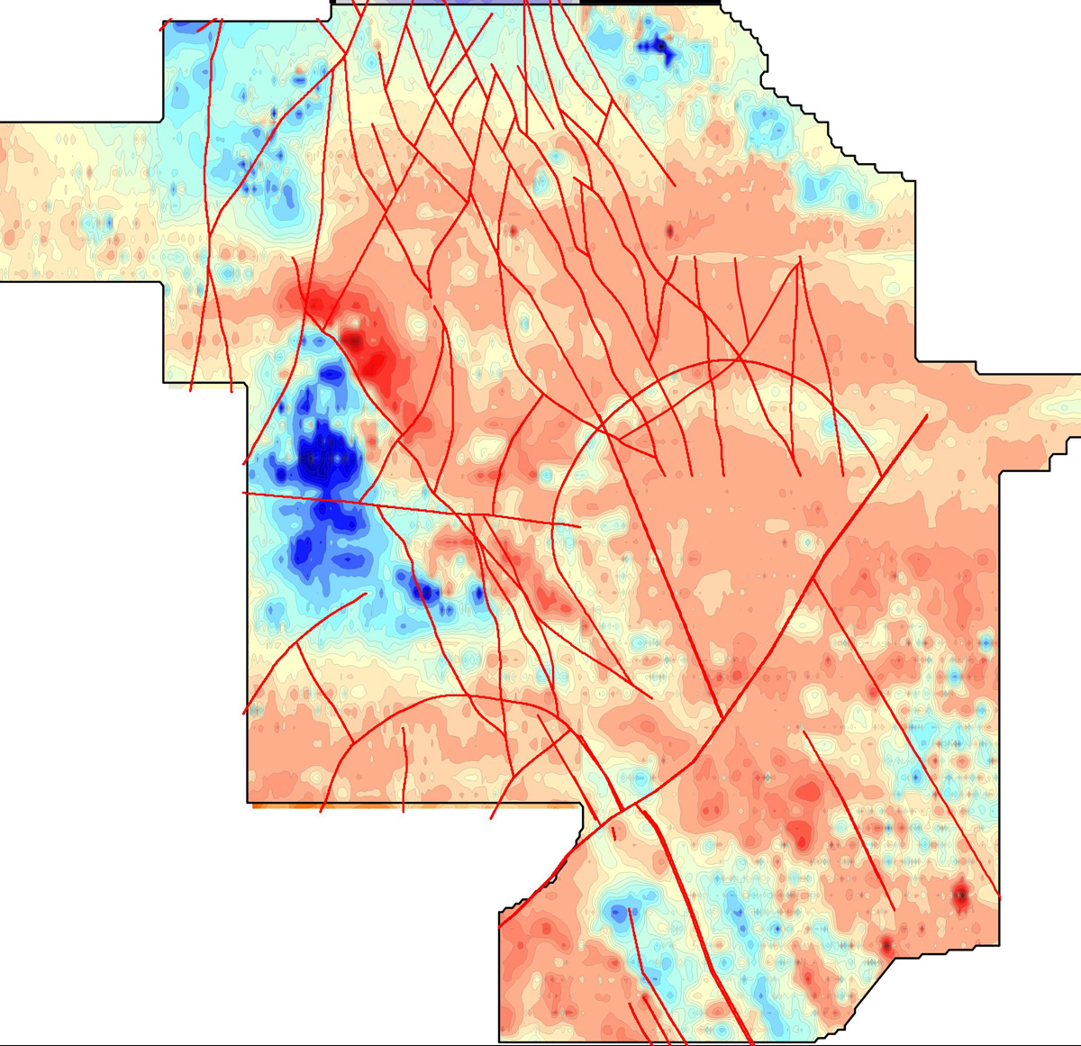
- The electrical method by implying different techniques: IP (gradient array), VES-IP (vertical electrical sounding) and PS-IP (point sounding).
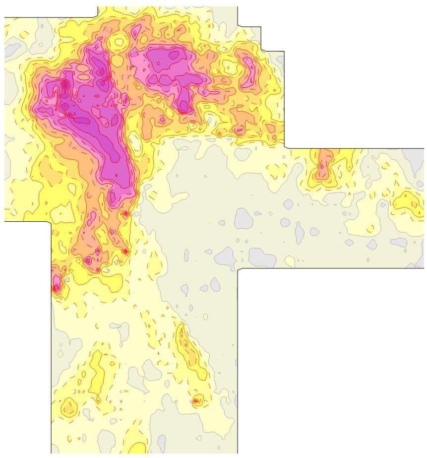
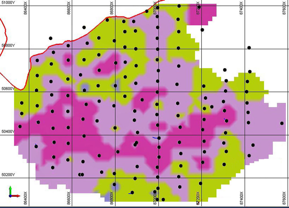
Map of IP anomalies. - Magnetometry.
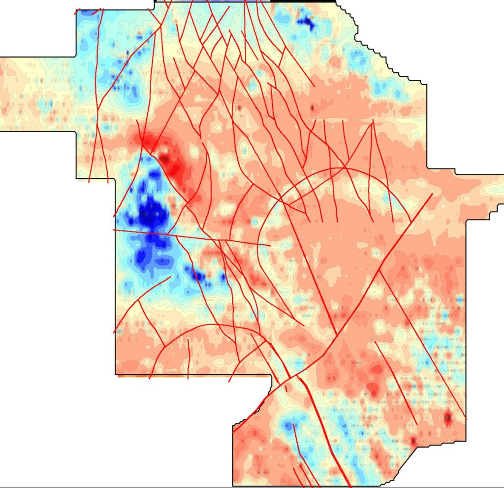
Map of anomalous of total magnetic field (ΔТ). - Analysis of results, data interpretation, and preparation of related maps and graphs, identification of anomalies and assessment of their prospectivity.
- Digitizing, re-interpreting existing data using modern software and approaches.
- Consulting on geophysics.
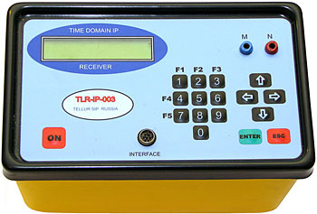
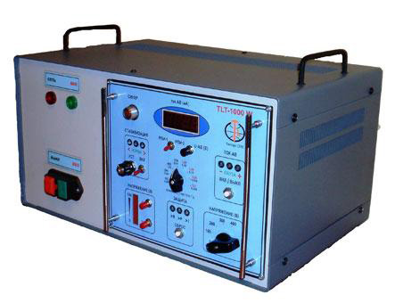
We use state-of-the-art equipment of Russian (Telur SPB CJSC) and Canadian (GSM-19) production and our geophysical services meet modern industry requirements.
 |
|
| Receiver TLR-IP-003 (Russia). |
Transmitter TLT-1400 (Russia). |
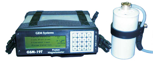
Overhauser magnetometer GSM-19 (Canada). |
|
They provide gathering high-resolution data, have noise (signal distortion) immunity and are reliable in the field. When interpreting the results of fieldwork, modern softwares are used, particularly, TLM-1.6; 2D Overvolt; 2D Relief Tellurium Magnet 2.3, Surfer; Oasis Montaj; Autocad; Grapher; Zond-IP.
- Creating and maintaining a sampling database.


- Data interpretation and block modeling.


Closed Wireframes, 3D View. Distribution of Mo in Sulphyde Zone. Distribution of Cu in Supergene Zone. - Pit optimization and resource estimation according to Australian JORC code and Canadian standard NI 43-101.

Block Model, 3D View. - Design of further exploration activities based on a model built.
- We use MICROMINE other software for the implementation of the mentioned tasks.

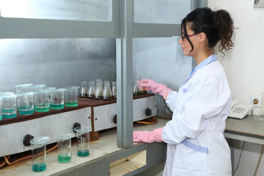
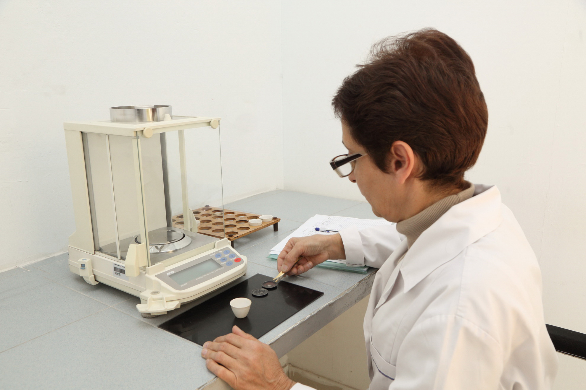
- Laboratory services of geology – mineralogical and petrographic studies, bulk density determination of rocks, determination of some physical and mechanical parameters of rocks and etc.
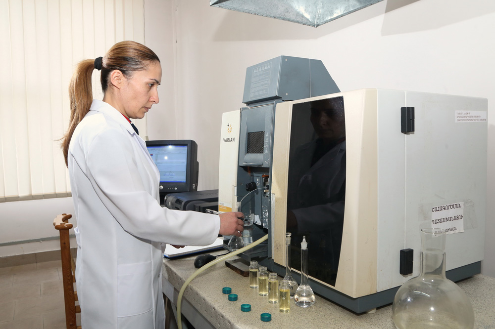
- Analytical laboratory services – chemical and phase assaying.


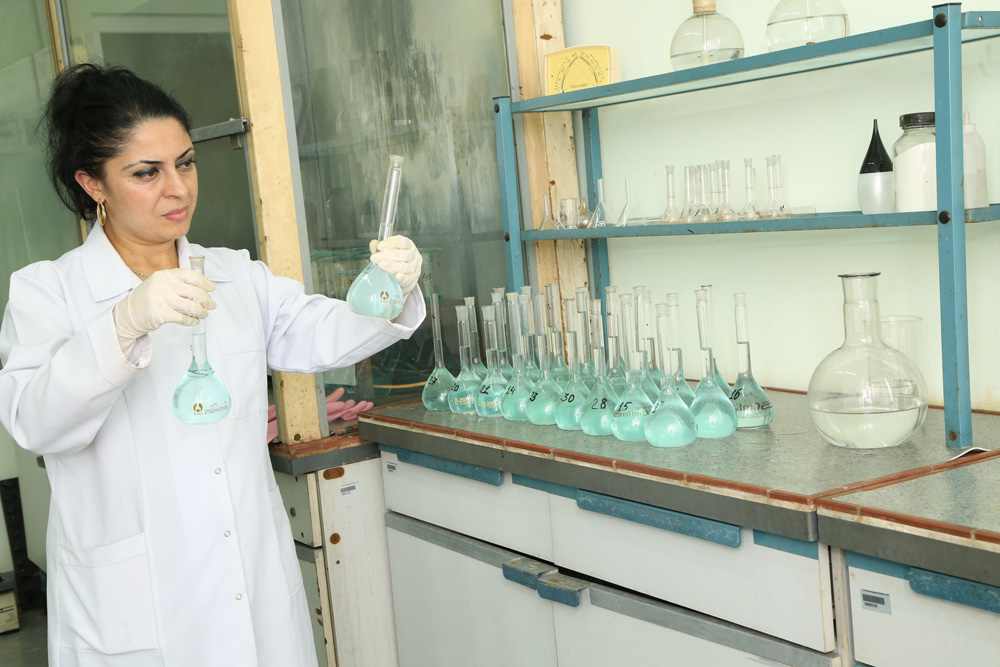
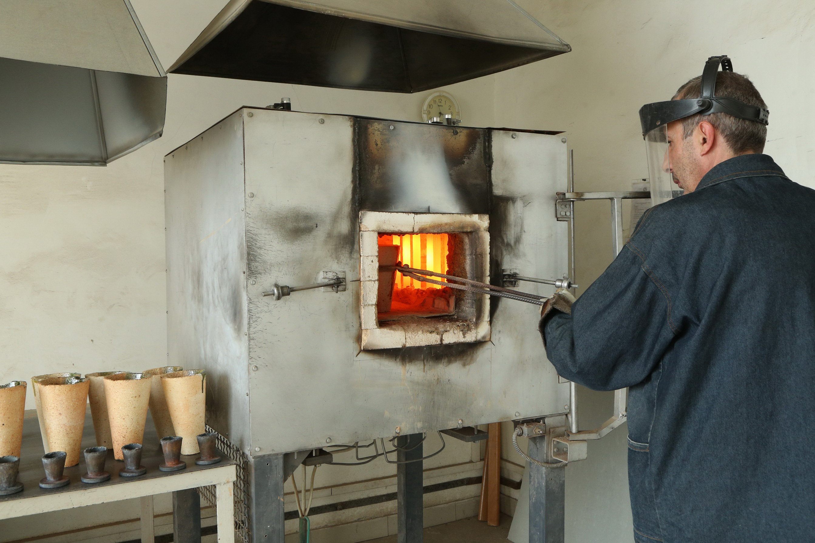
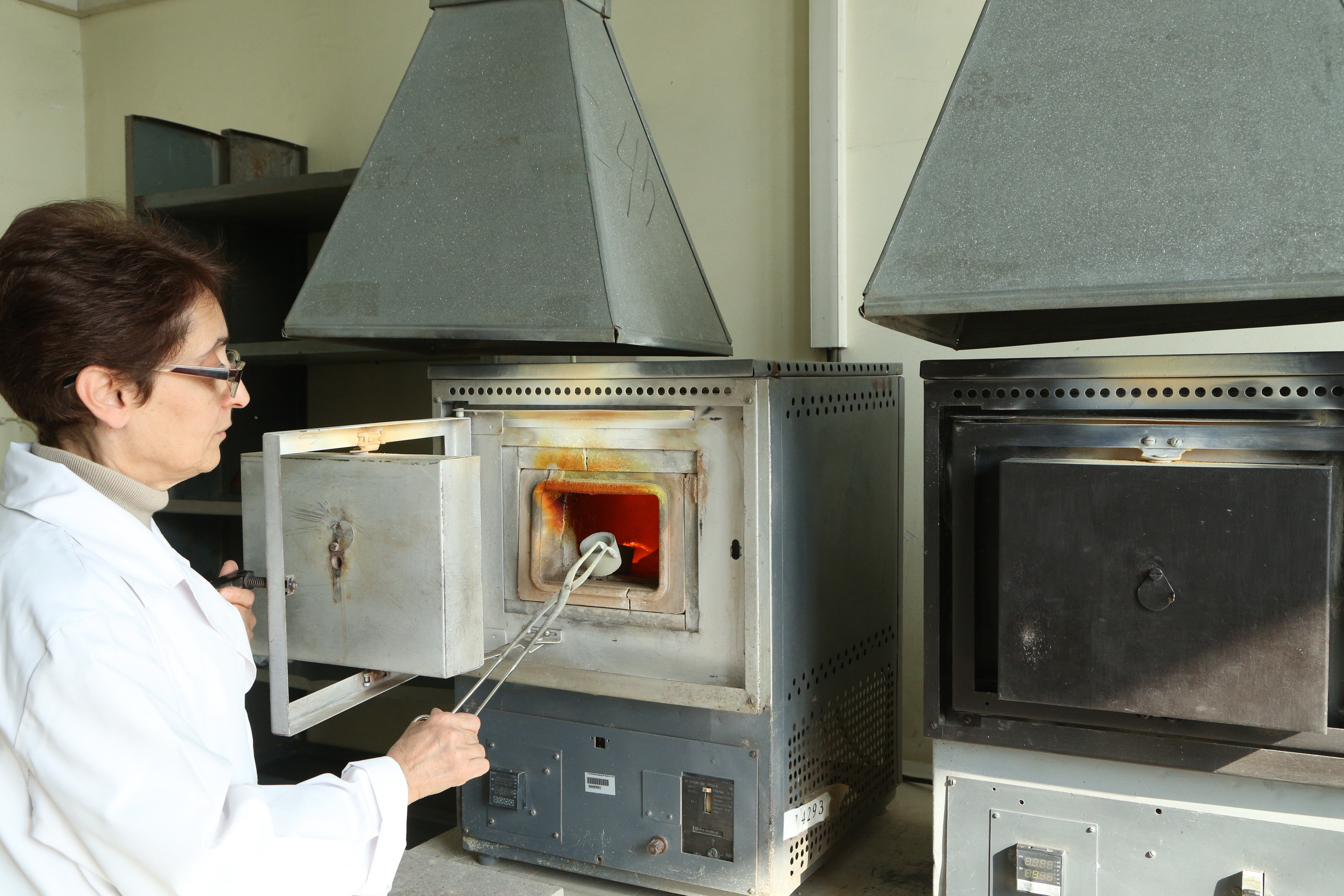
- Fire-assay laboratory services – gold and silver determination by fire assay method.


- We perform rapid and high-resolution topographic survey by using drone-attached equipment.